Preface: There’s a new heading at top of the page called “virtual tour.” Covid-19 has changed everything. Now it’s not alarming to walk into a bank or business establishment wearing a mask. Many people commute from bedroom to desk, and a really long commute is one that involves stairs. I’ve been to a few remote concerts already this week, and virtual travel is happening without getting beamed up or down. Webinars and Virtual guides are popping up everywhere, and zooming has a whole new meaning.
Today I begin posting a “virtual tour” across New York state by the waterway that changed our national history. You don’t need a ticket or a passport or a subscription. We’ll take some zigs into the surrounding land, and some zags into history because we don’t need to stay between the channel markers. Transit from the Hudson River to Lake Ontario will take ten posts, ten days. Also, to avoid confusion, click here to find the distinction between 1825 Clinton’s Ditch, the 1862 Enlarged Erie Canal, and the 1918 Barge Canal, today often referred to as the Erie Canal. I’ll point out some vestiges of the 19th-century waterway. That distinction and other terms are defined here. Yes, some parts of the canal have been filled in, but those parts were obsolete already. Sal would certainly saunter along if he could, but he’s got other duties. Besides, Sal’s been replaced by Cats and Cummins and other mechanical critters.

Here’s a good place to start: a weathered and water-stained distance table I saw in the wheelhouse of 1932 Canal tug Seneca. Although I don’t know the date of printing, the table clearly comes from a time when commercial traffic on the Canal made runs between the sixth boro to Lakes Erie and Ontario routine. I’ll refer to it for distances now and again. In this series, we’ll head to Three Rivers Point, and then take the Oswego Canal/River to Lake Ontario.

We’ll begin just south of Waterford, the eastern terminus of the current Canal. Approaching from Troy on the Hudson, you’ll see

this sign in the town of Waterford indicating the entrance to the Canal, branching off to port.

Waterford, a town of just under 9000, is a fantastic stopping point for boats even today. Note the red brick visitor’s center and just to the right, the bridge leading over to Peebles Island. That Second Street/Delaware Ave bridge links this to a few photos farther below, taken decades apart.

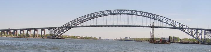
Before plunging into history, have a look at where these boats come from. Double click on most photos to get larger version. Often recreational boats,sometimes loopers, tie up there for information and provisioning; international yachts . . .

Great Lakes work boats,

and self-described slow rollers. We’ll roll quite slow too, to smell the flowers and avoid . . you know . . what Sal might’ve left behind.

To this day, commercial vessels that can squeeze under the 112th Street Bridge congregate in Waterford in early September each year for the Tugboat Roundup.

Can you spot the one tugboat that appears in both photos, above and below, taken more than a half century apart? It’s Urger, whose story is long and involved and can be deciphered here. The self-propelled barge, aka Eriemax freighter, on the wall to the right is Day-Peckinpaugh, which transported cargo on the canal from 1921. She’ll come up again later in the trip.

Note the same Peebles Island bridge? Judging by the barges, I’d place this photo at about a century old, back when the Barge Canal-iteration of the Erie Canal opened. The archival photos throughout the series come from the Digital Collections of the New York State Archives, and this is my credit. Visit the New York State Museum also virtually here.

In the next post, we enter the flight. For now, let’s hail the lock master on VHF and see if he’ll open gates. Click on the link in the previous sentence, and scroll, to see the friendliest lock master in my experience; as with anything, your experience maybe different. .
Consider this a work in progress. Nycanals.com maintains extensive info about every lock in the journey on their site.
Any additions, corrections, or other comments are appreciated. I have literally thousands of photos of the canal, but would welcome your best as well. I’d love to make this an ever-growing communal project. Let me add one more from the 2008 Waterford Tugboat Roundup.

Again, black/white photos from New York State Archives, Digital Collections. Color photos WVD, unless otherwise stated.
Fred of tug44 created a systematic tour here several years ago. Sally W went through the same itinerary from June 11 until 22 in2012.


12 comments
Comments feed for this article
April 17, 2020 at 11:45 am
asrdriver
My more infrequent (now) grocery and hardware runs typically take me over the canal on Wayneport Road, which of course runs past Wayneport. Interesting to note that Wayneport is one of the ports and distances listed. The basin is still there, and at low water when that Canal section is partially drained over the Winter months, the wall is quite visible, as is the old channel into the basin. The old Erie stonework for the wall is still in great shape.
April 17, 2020 at 12:53 pm
Elaine
Given the lack of an easy click of the ‘like’ button – THANKS for the time / effort / love put into all of your material. We are especially looking forward to this series.
-R
April 17, 2020 at 1:01 pm
Linda Roorda
I, too, really enjoyed this and look forward to the upcoming canal trip!
April 17, 2020 at 1:33 pm
Carol Ecker
i am on the erie canal up from 3 rivers in BELGIUM NY. love all posting, but this is great. thank you. wash hands stay safe and well😇
April 17, 2020 at 7:18 pm
John Callaghan
Great that you’re doing this. Looking forward to the virtual trip!
April 17, 2020 at 9:45 pm
Peggy Huckel
Great start, good links- it’s going to be a fun ride!
April 23, 2020 at 2:16 pm
Ingrid
This is great! I’m planning on moving my sailboat up from NYC to Toronto via the Erie Canal for part of the journey, and this is a nice preview. (The move was supposed to happen this summer but now, who knows when?)
April 23, 2020 at 2:19 pm
tugster
Thanks for writing, Ingrid. It’s my intention with this virtual guide to make your trip more interesting. Send pics from the trip . . . once the canal opens up. Also, please pass the link on to others who are sailing through.or who already have.
February 5, 2023 at 6:12 am
tugster
Thanks for writing, everyone. The NYS Canal system is a public treasure.
June 4, 2023 at 5:11 am
Thebubblytipsymermaid
Your waterways are fun. A treasure map and treasure could be an add. 🫧🫧💦 I am just splashing bubbly thoughts and ideas out loud.
June 4, 2023 at 9:14 am
tugster
bubbly tipsy . . .I’m always happy when you connect. Maybe we could “pool” our info and come up with a great treasure map. Thx for splashing the idea. Be safe and happy!!
June 25, 2023 at 7:09 am
Thebubblytipsymermaid
Maybe.💦