You are currently browsing the tag archive for the ‘Empire State Trail’ tag.
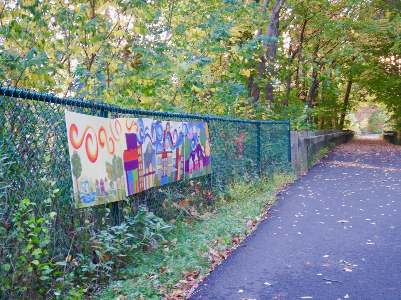
I started out from Schenectady, eager to reach the end of the trip. Improvised art exhibits covered fences in several areas of this stretch of the trail. I applaud the effort, but it seems an attempt to gild the lily or paint the abalone. I’m not disparaging the art, just the location.
The text here is very clear; don’t leave the bike trail.
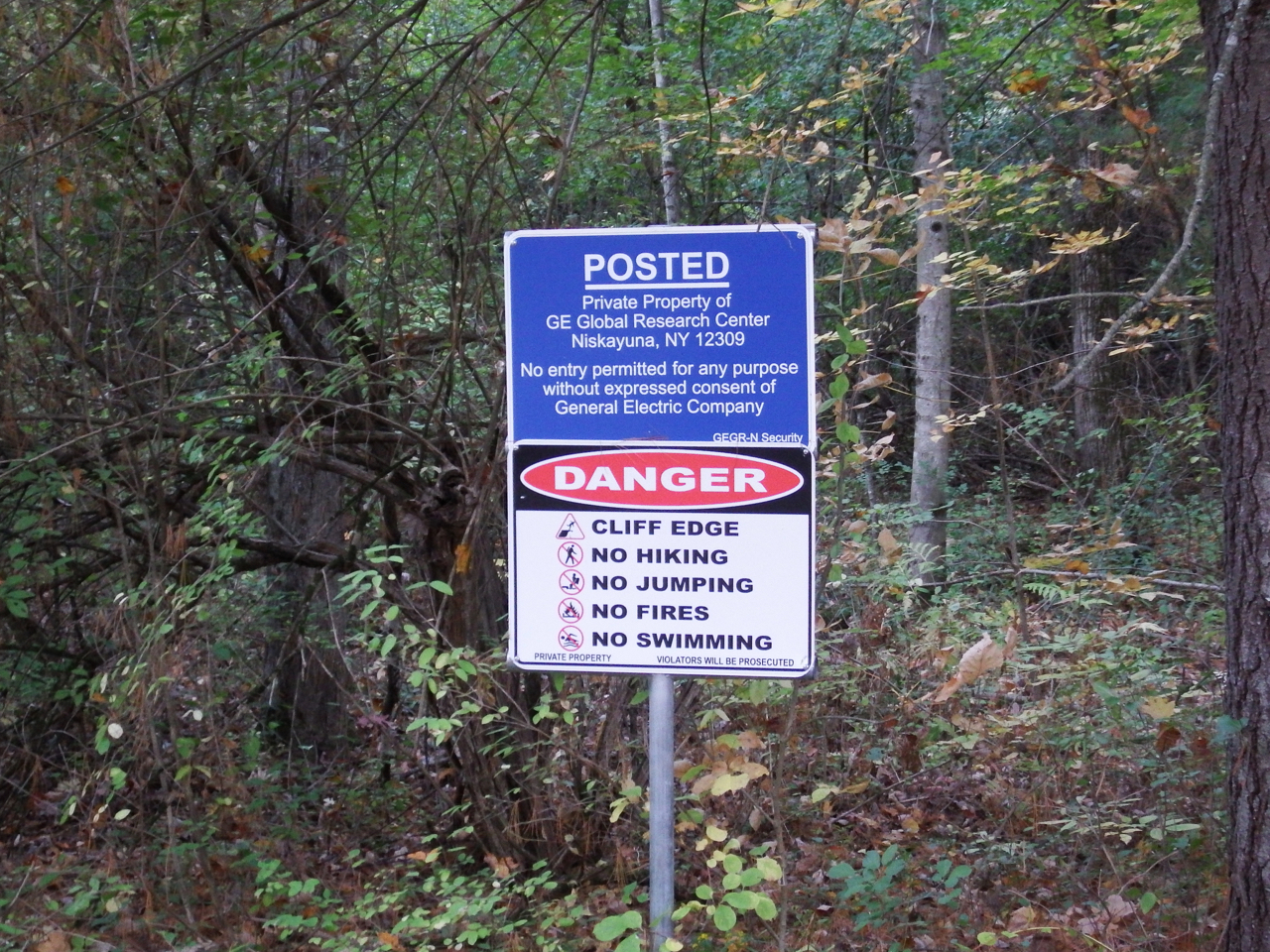
Besides a steep hill and cliffs, GE Global Labs and Knolls Atomic Power Labs lie beyond the fence and foliage. A lot of deer grazed there also.
If I read the map correctly, Jeff Blatnick Park has been built on a former landfill.
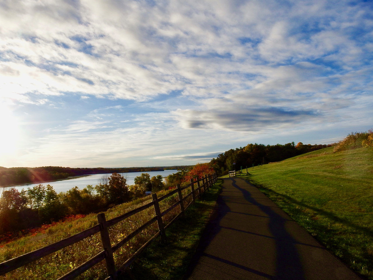
It is a very pretty spot.
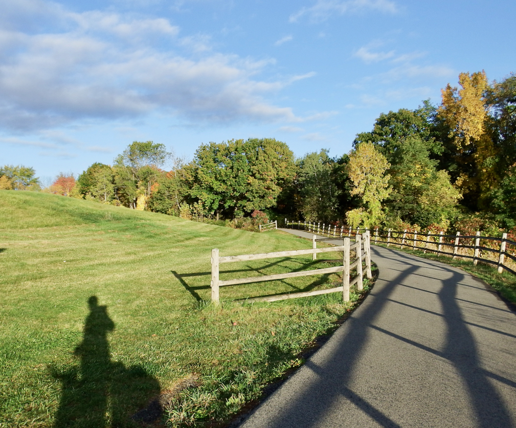
Trees here, as they do on downstate parkways, mask the subdivisions on either side.
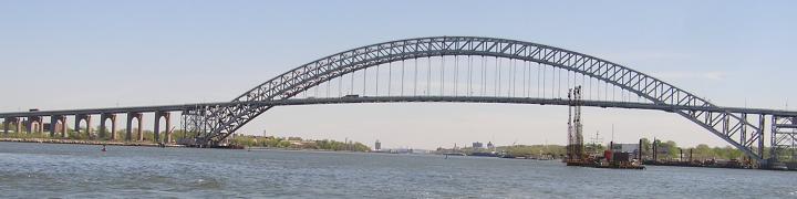
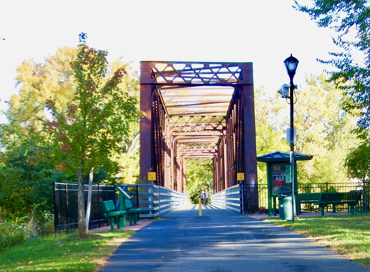
If the Empire State Trail here follows the D&H railbed, then this is Black Bridge between Green Island and Van Shaick Island.
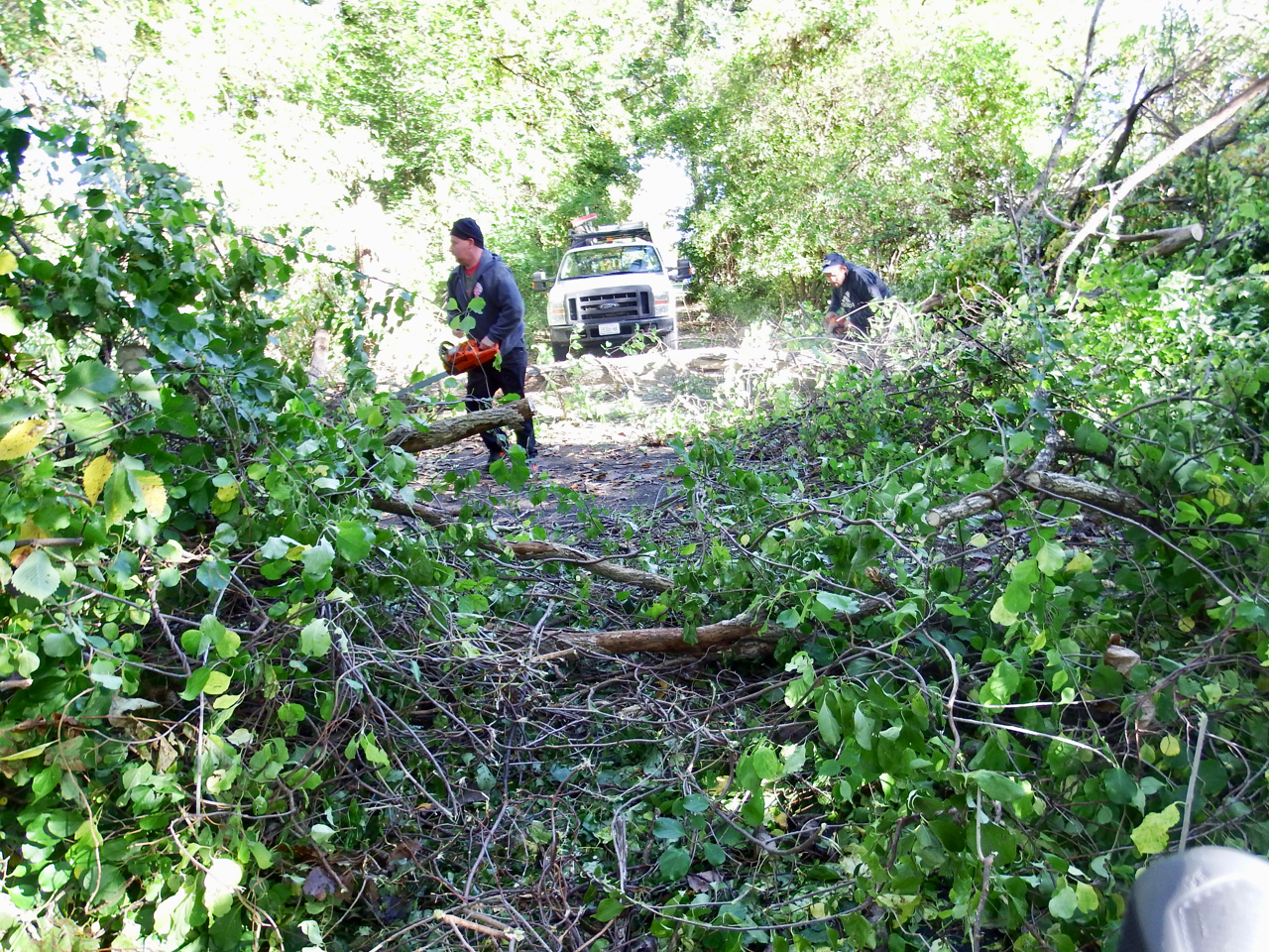
The storm still had obstacles for me . . . hastily being cleared by good citizens, they called themselves. I was appreciative.
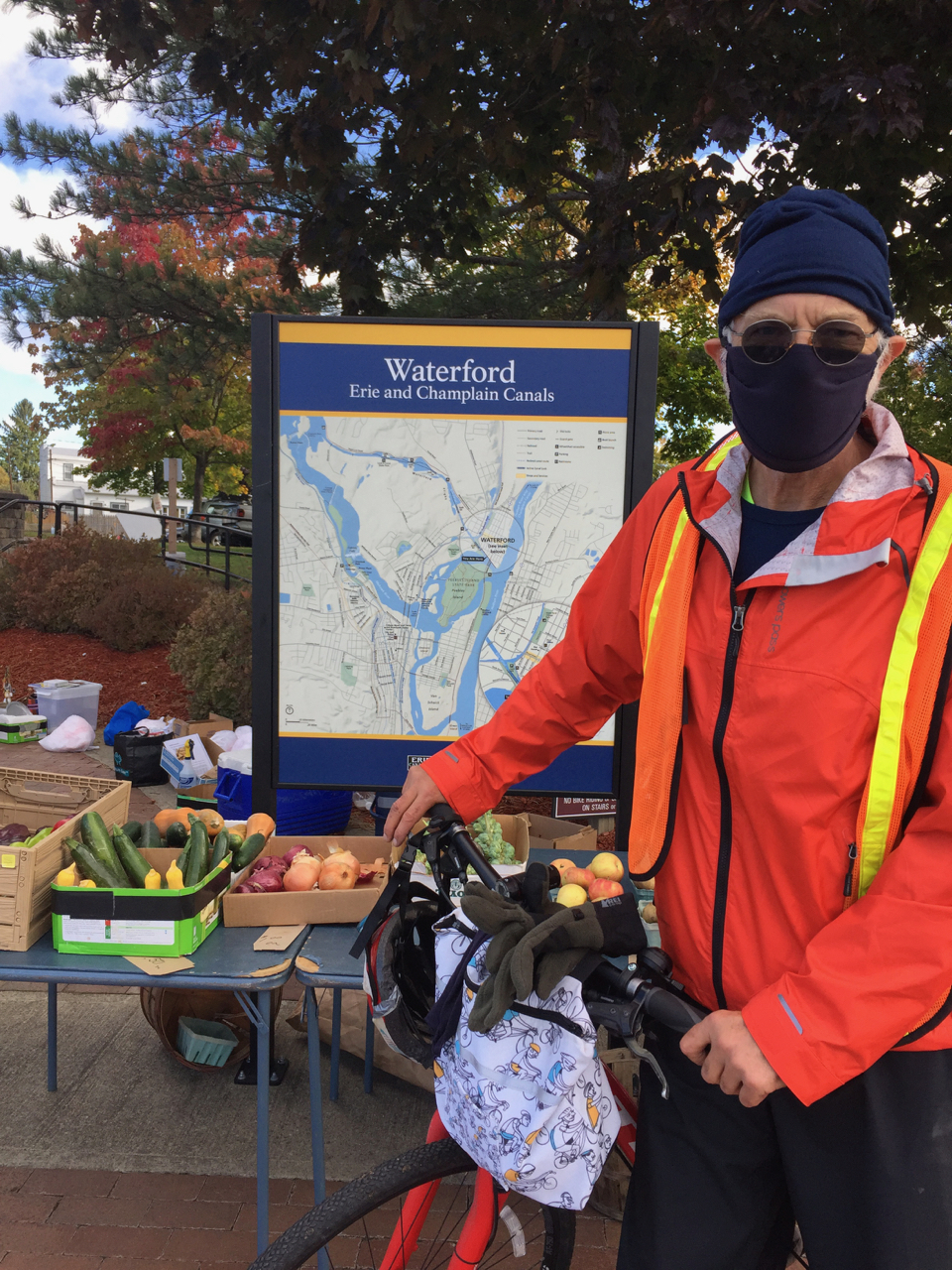
And then, I crossed the Second Street Bridge in Waterford, and after 334 miles, it came to an end. I realized later that the gent who took my photo was a vendor at the Waterford Farmer’s Market. I still craved an apple, but his were all sold out.
Conclusions?
- It felt very good to complete. I talked with very few people, making it ideal social distancing. Inhaling all that forest-filtered air does the body good, even my 1952 body. I actually set out, doing so publicly, not convinced that I’d complete the trip. Doing it publicly made it harder to bail out of the mission of completing it.
- Fall is a great time of year to bike it. I sweated, as one would cross country skiing. Summer heat might be intolerable.
- It was not about speed or racing. The journey was paramount, but once underway, I stopped more often for gulps of water than for taking photos. I saw many beautiful things I did not photograph. Most of my focus was up to 50′ ahead of the bike, as I scanned for holes, root heaves, and sticks. I also saw many historical signs I raced past. Momentum eclipsed puzzling out historical signage; maybe I was wrong in making that choice, but I had done my history homework in advance.
- My interior sentience was not about solving the world’s or the state’s problems or hearing music; rather, when thoughts coursed, they were about refuting political slogans I saw on too many signs. The wooded areas were more inspiring, even in their non-verbal way. If I do the Appalachian trail, I hope I won’t see those signs. Next year those distractions will be gone.
- Calling it the “canal trail” is misleading. “Rail and canals trail” as a name might be more indicative of what you’ll see. Having transited the canal to a terminus about 20 times, I know what the “canal view” is. Here’s the virtual tour I put up after numerous boat trips. A bike trip does not get you a boat view. It gets you a bike view. I’ve discovered a new curiosity about the trains that ran some of these corridors. Here‘s more on the West Shore RR.
- If you missed it before or if I misquoted myself since, my total was about 334 miles which I did in 53.5 hours over a seven-day period. The mileage is calculated from a map, not an actual recording device. The fourth day I made no miles because of the storm. The 53.5 hours is elapsed time from morning departure until end of day leaving the trail, i.e., the clock kept ticking while I did things like take a break as in Little Falls or wait for the electrical line repair crew clear a live wire off the trail
- Next year the trail will be better.
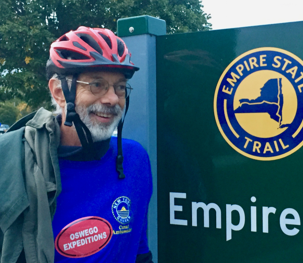
- Thanks for following along. I’m not a cyclist really. I don’t own a bike. The Trek I used is available through Oswego Expeditions. But if you have questions about the trail, I’m happy to consult.
- Solo v. groups? I was fine doing it solo. One benefit of a solo journey is that I was more disposed to enter conversations with strangers, and I met some interesting ones. That is less likely to happen if you’re boating through.
- Now . . isn’t this blog called “tugster”? This hiatus has reached its end. Back to “tugster” next.
Leaving Rome crossing the contemporary Canal to follow the south side of the canal for a while. That building is in what’s called Rome’s Bellamy harbor and just before that greenish guard gate, that’s the confluence of the canal and the Mohawk River, which enters there from the right. You’ve seen that guard gate once before here.

Rome is the summit between two watersheds, so water transport for millennia made a short portage here. To the Haudenosunee, this place was called deo-wain-sta . . . or carrying place, aka Oneida Carry.

The trail to Oriskany was muddy from the earlier rains, made worse for bikes by a four-wheeler that had gone through. I grant that the four-wheeler may have been looking for downed trees.

But the sun came out . . . and past the swamps that bogged down General Herkimer back in 1777, the trail follows directly south and adjacent to the contemporary canal.


Governor Roosevelt waits in Marcy, lock 20. She’s been working since the late 1920s.

Here’s Tender #4 on the hard and Governor Roosevelt in the distance.

I had a big surprise when I approached Utica’s Genesee Street bridge, and saw Jeff, captain on Urger when I worked on her, part of a safety meeting on shore before they headed onto the boats for dredging.

South of Herkimer/Mohawk after lots of miles from Utica on route 5N, I passed Fort Herkimer church, among the oldest churches in the US.

Having watched this section of the trail being build the past few years, I’d been looking forward to riding it, just above lock E18.

I got to Little Falls, my easy goal for lodging, but since it was noon that I got there, I rested for an hour, and then I pushed on.

The trail east of Little Falls is spectacular.

The storm I mentioned as having kept me inside the day before had done a lot of damage, downed trees and power lines.

This Holland Power Services crew had come from New Brunswick to assist. Their safety flagger stopped me for half an hour while this live wire was re-attached to the pole.

Once I got the all-clear, I was on the road again . . . well, on the trail. I passed tug Port Jackson at lock 15 in Fort Plain, and made for my day’s goal, Canajoharie and Palatine Bridge.

Report and photos, WVD, who had completed a 59-mile day.
I spent two nights in Camillus because the forecast saw high winds and rain. A day in bed did me good, although I felt a bit guilty until the rains came. In early afternoon, when I took the photo below, I took this color photo from my window, feeling happy to be indoors.

The next morning, headlamp on, I made for the bike trail. I was crossing the main rail line when the sun rose. After several miles of riding, I crossed it again because of an unmarked detour on the trail. A trail bridge at the SW end of Onondaga Lake was under construction or repair, which led to a long back track. For a story highlighting the connection Syracuse once had to tide-and-salt water, click here and scroll to the bottom.

I had google maps as well as Gaia GPS, and it cost me a lot of data, but I made it through the labyrinth that was Syracuse. Highlights were the Niagara Mohawk Building, and

a short revisit outside the Erie Canal Museum. Significant is the fact that Erie Boulevard, seen to the right on the photo below, is a portion of the 19th century Erie Canal that has been filled in. Other “Erie Boulevard” locations in NYS are also atop these filled waterways.

Once east of the streets of Syracuse and eastern suburbs, I made it to the 36-mile Old Erie Canal State Park, a welcome relief, and a must-pedal area of the trail. The trail lies atop the towpath, and long stretches of extant canal have water in them. I saw folks fishing.

A few years ago in the fall I’d visited Chittenango Landing Canal Boat Museum, where I took these photos of circus life on the canal. There’s much more to see as well. For now, I had miles to go . . . so andiamo.

I stopped to see vestiges of 19th century industry, like this clay pot factory, located for easy and safe transport of the fragile cargo. Now . . . we choose to use plastic ones . . .

Onward . . . I zoomed through Canastota, my “easy goal” for the day. Then Icrossed the NYS Thruway and headed for Rome. The trailside of the Verona town buildings made for a “canvas” for muralists. The Stark’s Landing reference means that this location a century and a half ago served as a transport and cargo handling center.

Now this section of the canal was empty and although land was farmed, no indication remained of the previous supply chain modes.

Eventually I crossed the contemporary canal at lock 21, passed the junction lock, and followed the NE bound trail into Rome. For some good views and the “junction lock” and the NE bound trail, click here and see photos 3 and 4 from last.

It was another 50-mile day . . . technically longer given the detour just west of Syracuse city.
Report and photos . . . WVD.
The trail was in utter darkness, but headlamp riding had agreed with me the previous leg, so I thought to do it again. Since Newark was the site of the new Urger mural by the mural mania folks, I wanted a photo by the mural, a photo I was too tired to take the afternoon before. My brother did the honors.

A half hour later I was at the section office in Lyons, where I’d been told by Wendy Marble that she would already be working. A knock on her window yielded this photo by Wendy. Note my reflective, high-vis outfit.

After a brief chat, I returned to the trail, past lock 27, and then to points east, on a refurbished towpath beside the 19th century iterations of the Erie Canal. Initially it was smooth cinders, but not much farther, I encountered the worst trail conditions of the trip . . . before Lock Berlin, just a grassy bumpy and rutted, cleared strip. I dismounted and pushed the bike.

At Clyde, I crossed the contemporary canal for the first time that day.

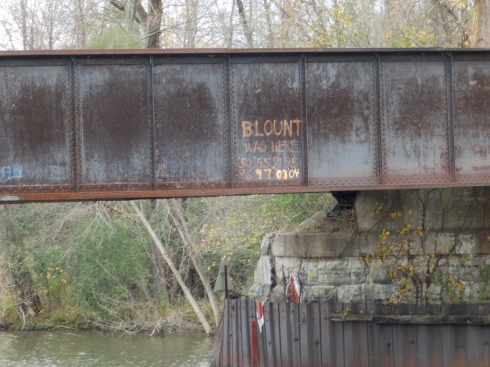
I’d long wondered how I’d cross the infamous Clyde railroad bridge, the lowest clearance of the western canal, the bridge marked by Luther Blount on subsequent transits. For more context on the E-93 bridge that once carried the West Shore RR, click here and scroll.
From the bike trail, that bridge looks like this as I crossed the contemporary canal the second time on day 3.

Surprisingly soon after crossing the bridge, the trail led to Route 31, and I “shared the road” with cars, trucks, tractors, and huge harvesters . . for about 10 miles.
Eventually, I got to the east side of Port Byron, and after delicious pulled pork from the local grocery/caterers, I found the trailhead . . .

I had 20 miles or so to do yet that day, basically because I’d attained by goal of Weedsport by 1230, and figured it was too soon to take a room.
Near Weedsport, the port of Mr Weed, the trail crosses a bridge alongside one of 18 aqueducts operating in the 1860s. I passed the bucolic scene, but I didn’t linger.

The trail was narrowed to a single tire track.

I stopped in Jordan, lock 51 of the 19th century canals. Many sights and signs beckoned, but I had miles to run, and the forecast for the next day was not favorable.

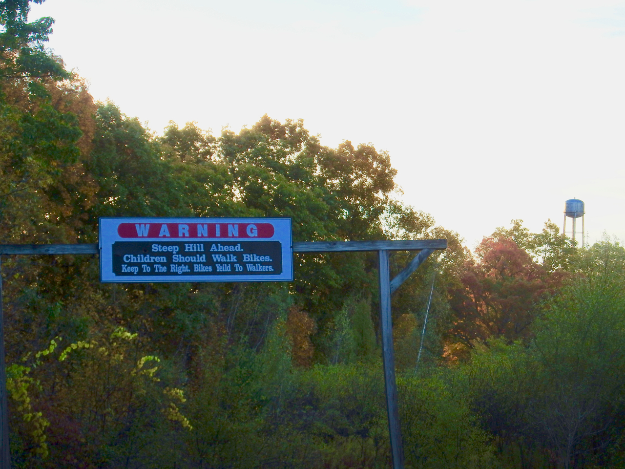
I did stop to take stock at this sign; assessing my progress, I felt quite good . . . three days in the saddle and close to the midpoint..

Camillus is the home to a working aqueduct: for a price, folks can ride a vessel through an aqueduct. Alas, I rushed to find lodging, and took no more photos . . . day 3 compete, 51 miles for this leg and over 160 miles total.
Report and photos by WVD.
Thanks to all who read installment 1. Earlier 2020 I posted about a water tour from west to east that included toddy’s portion of the canal here. Besides a difference in perspective, bike v. boat, the activity of the photographer is very different. On a boat, your hands are free to grab the camera whenever you choose as you navigate; on a solo bike, taking a photo means stopping, removing gloves, unpacking camera, and shooting . . . all antithetical to covering territory.

I departed Albion before 0600 because I wanted to make Newark, 67 miles away, a goal 20 miles farther than I had day 1. To achieve this goal, I wanted an early start. My helmet-mounted headlamp was adequate in the hour + of darkness I rode. Traveling then also meant no trail traffic, except a few runners, and no wind, which had plagued me the day before.
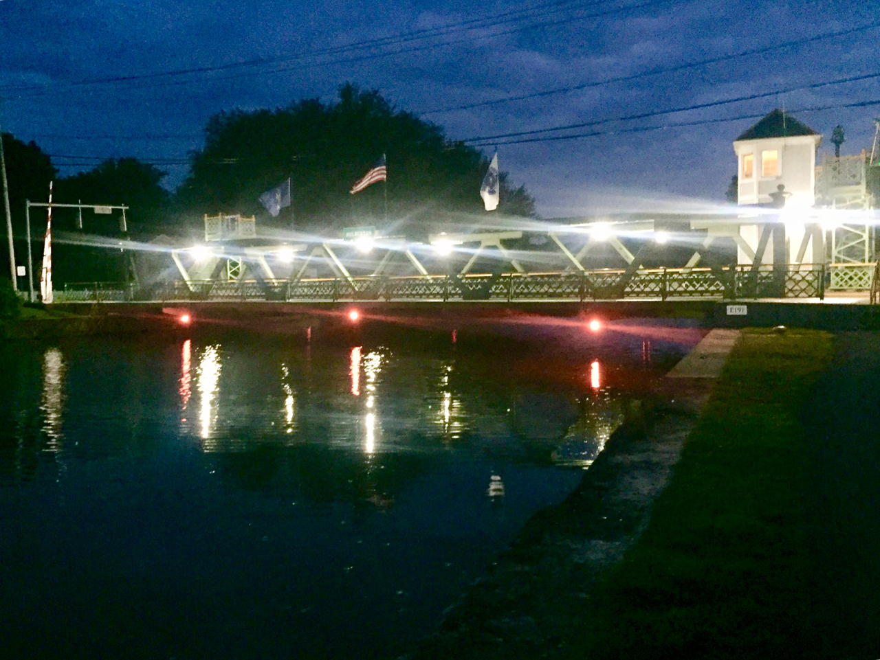
As the overcast day brightened, here’s what the lift bridge at the hamlet of Hulberton looked like. With a boat, you’d not be able to travel at this hour, because lift bridges like this are not open for the lifting business at this hour.
Camping happens at parking lots along the trail, as evidenced by the big blue bus identified here as steampunk steve.tv whom unfortunately I did not meet.

The trail basically looked like this. It needs to be pointed out that during the first two complete days of riding, the trail follows an active portion of the canal, ie, to the right, a vessel under 15.5′ air draft can get from tidewater to the Great Lakes via that waterway.

By the time I reached Adams Basin, I’d switched off my headlamp for another day, and I watched a maintenance crew start of their machinery for another work day.

Next landmark was Spencerport, time for a swig of water, a stop, and a stretch.

Soon afterward, I was getting worried about finding the routes through Rochester. The trail was mostly well marked, although there’s not the sense of the canal through Rochester as a trench cut through rock as you get from a boat. I pedaled hard until I was through the city, found my way again after getting lost in Genesee River Park, I passed the strategically placed REI.

I stopped for a gelato right next to the boarding area for Sam Patch,

and realizing there were still over 20 miles to my destination, set out stopping at the Bushnell Basin info….


zoomed through a Fairport under construction because of the crooked bridge, and raced through the part of a county I grew up in, stopping only to photograph a sign for a place I never knew here.
There it is . . . my only photos from day 2 of the ride.
All photos, WVD, who slept in my erstwhile hometown that night.
In that case, en avant, I should fuel and lubricate the tires. Sunday 0735.

This is the look of focus! I soon stopped and put on my gloves.


I encountered three types of surface . . . the cinders path increased effort for the “hybrid” tires I used. Just roughly speaking, I’d say roughly 35% of trail now is cinders, another 40% is paved, 20% is “share the road” street and highway, and the rest is grassy. Work is ongoing, so next year the percentage of paved portions will be higher, and grass and highway lower. The best thing about towpath and rail trails is that they are straight and level.


This last photo of tug Pittsford I took in Albion NY, where I spent night one, in a motel. I really needed a hot shower every night.

All photos, WVD, who returns to the sixth boro and focus on its traffic after this report.
A final word . . . I’m not a regular cyclist. Prior to this trip, I’d not sat on a cycle seat for over five years. I am, however, an avid walker. My bicycle was a Trek Dual DS2 provided by Oswego Expeditions, a very good bike and outfitter. Thanks, Jennifer.


Recent Comments