You are currently browsing the tag archive for the ‘Delta King’ tag.
I’ve always called this a “waterblog,” and this post is no exception. New York state has a complex water system, but California’s is much more so. With this post, I’m foolishly trying to capture the water story based on a trip from from Sacramento to LA, via 99 to Bakersfield, then west to Buttonwillow, over a range to Soda Lake, then Taft, back toward I-5, down the Grapevine into LA; ie, the central valley and southward.
I hope these few photos drive a complex story, beginning with Delta King in the capital, over 80 miles upstream and through the delta from the Golden Gate. Of course, the California water system starts way farther north than Sacramento.

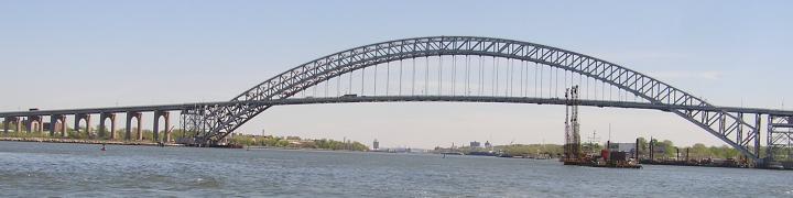
See those ships higher than the land?

The one to the left–Aurora— has a quite tangled history itself. You could be working in the fields here and look upward to see the ship.

The delta has many islands; for names and more info, click here. With complexity comes conflict like this.

Port of Stockton itself is 75 miles from the Golden Gate; four saltwater ships were in port the other morning,

as well as a range of smaller vessels . . . .

After almost 250 miles on 99, we drove through all manner of agriculture, we turned off at Bakersfield. Why Merle Haggard Drive? That’s a water story too.

It’s all ag fields from here to the oil fields as we head west to a remnant of the sea that once covered the area.

From the top of the Tremblor Plain, we look back east toward Bakersfield. See the black speck, somewhat center tending to lower right? That’s a grazing Angus.


If Tremblor suggests anything, it’s deliberate: those are spring wildflowers on the San Andreas fault.


I need to come back here on a day the oil museum is open in Taft.

Oil and water do mix in this state.


x

Blunt and clear might save your life.

For an excellent overview of the whole California water system, visit the vistor center near Pyramid Lake.

The photo above is just 25 miles from downtown LA, where our destination was the Amtrak station for a jaunt east, the next installment.

All images, any errors, WVD.
Sticking to the format, days 5 and 6. Enjoy these from Salinas to Sacramento, traveling in the rain at the speed of light. I chose this representative group while drinking morning coffee as well as while sleeping. I’ve tried to arrange in chronological order.

It was too early to try the deep-fried artichokes at the “center of the world.”

Elkhorn Slough, and buildings of what once a dairy farm.


Pescadero Beach looking south and

north

Sausalito

includes a houseboat made of former City of Seattle and

barrage balloon barges.

Beached locals and

and grounded Polaris at Rodeo.

Sandra Hugh assists.

Delaware bunkers.

Cape Fear LASH in Saisun Bay.

Then farther into the Delta [the size and complexity of which I had grossly failed to appreciate] to transit the Sacramento River on The Real McCoy II portion of Route 84 and

then ride the levee looking for


All photos, any errors, WVD, with thanks to George Schneider for local knowledge. Not included here are the other 500+ photos I took.


Recent Comments