I traveled RT by air last week, and as usual, tried to spot landmarks, entertainment for the map fan that I am.
Mount Vernon is how the smart phone labels it. I’d call it a view of Mobile Bay at dusk, looking south.

I concur with the phone that this is New Orleans, one of the bends in the river below the Crescent City.

Westwego is a western suburb of New Orleans. I see those bulk carriers anchored in the river and I think of all the wheat and beans grown along the Mississippi River system (or the Missouri River system) to be exported in their holds. If you want a long fascinating read by John McPhee on the river system, click here.

After five intense days in Louisiana, I was back at another airplane window seat. It was a foggy morning over the Crescent City.
Westwego again gets the label.

River Ridge is another western suburb of Nola. These bulk carriers, like the ones a few photos above, will likely take grain and beans for export.

Cambridge MD appeared after almost a couple hours of cloud cover. I took the photo because of the “outlined” island. A little research told me this was Poplar Island, a restored island created with dredging spoils.

Greenwich Township seems wrong as a label, but the Salem Nuclear Power Plant is unmistakable. Also, along the top of the image is the sinuous C & D Canal.

Matawan seems alright as an identifier, since this is the mouth of the Raritan River and the west end of Raritan Bay.

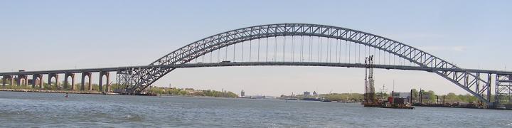
Brooklyn-Fort Hamilton is not visible, but the concentration of orange vessels clearly marks the the east end of the KVK, and beyond that Bayonne, Newark Bay, and Port Newark.

Brooklyn. Need I say more? I find it curious, though, that from this perspective the 1WTC gets lost in a cluster of its neighbors. With all the new tall buildings in central Brooklyn, One Hanson Place, long the tallest building in the boro, has gotten lost near the intersection of Flatbush and Atlantic.

Brooklyn is below in this view across to lower Manhattan and Jersey City.

Flushing-Queensboro Hill means we’re about to land, once we make a hard turn to port. Note the Unisphere and 1WTC on the horizon. The circular body of water in the foreground is called by the unlikely name Fountain of the Planets.

All photos, WVD, who previously did similar shots here.
A friend recently suggested that “gallivant” should be my middle name. There’s no need to make it legal, but maybe I’ll get it embroidered onto my hat and jacket.
The first batch of calendars is in the mail as of this morning. The price this year is $20. I have about 10 left.


7 comments
Comments feed for this article
December 7, 2021 at 3:18 pm
Bob
Beautiful shots. You should have asked the pilot to make another circle over the city.
December 7, 2021 at 3:25 pm
tugster
The conditions were perfect; I must have booked the sightseeing flight.
December 7, 2021 at 5:14 pm
ws
Winglets https://en.m.wikipedia.org/wiki/Wingtip_device
SI ferry, All nice!
December 8, 2021 at 12:15 pm
William Lafferty
These are great. I have never seen such a clean aircraft window. I try to take shots aboard but the windows are always too dirty or scuffed or both to render a decent image. Then again, I invariably fly Embraers on their last Dunlops, so that probably has something to do with it.
December 8, 2021 at 12:23 pm
tugster
Those windows must have been new, William. Here’s my suggestion to the airlines for a “book online” choice: you can now request, even pay a bit extra, for a crystaL-clear window seat.
December 10, 2021 at 2:42 pm
js
Boy,you lucked out on that descending into New York window seat..Were the other passengers as thrilled ?
December 10, 2021 at 4:34 pm
tugster
They were. Guy behind me was from New Orleans, and asked me to point out the sights. I did and he was thrilled.